The Palestine Archipelago
The fragmentary reality of Palestinian territory
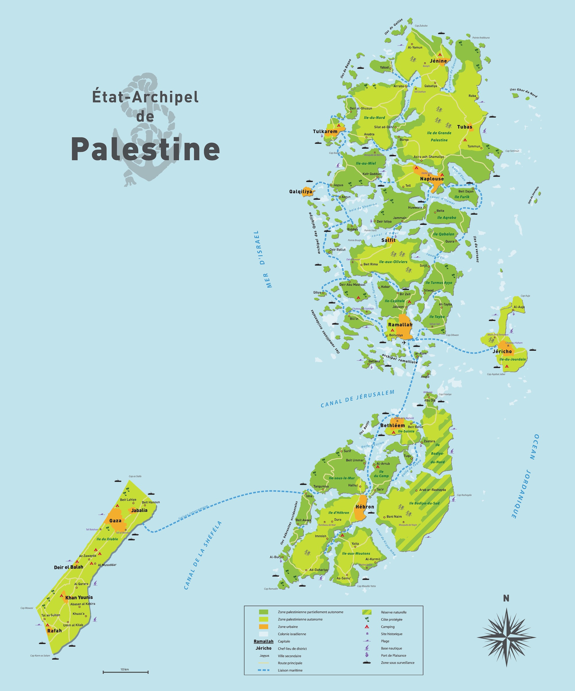
This year marks the 30th anniversary of the designation of Area C (Wikipedia), the 62% of the occupied West Bank that Israel kept exclusive control over under the Oslo Accords. That thirty year span is longer than the 28 years of Israeli military occupation of the West Bank that preceded it, longer than the 22 years of Jordanian rule before that, and longer than the 28 years of British Mandate administration before that. Promised as a transitional stage, in which the land would be “gradually transferred to Palestinian jurisdiction,” Israeli rule over Area C is as close to permanent as any form of rule in modern Palestine.
In 2009, French cartographer Julien Bousac created a striking visualization of the fragmentation imposed by Area C and the continuing occupation of Palestinian territory. That map imagined Israeli controlled areas parts of a sea, inaccessible to Palestinians and posing fundamental challenges both to movement within their country and to any independent future.
I share it here as a starting point for envisioning Palestinian reality before the 2023 Gaza war.
| Symbol | Description |
|---|---|
 |
Partially autonomous Palestinian zone |
 |
Autonomous Palestinian zone |
 |
Urban area |
 |
Israeli settlement |
| Ramallah | Capital |
| Jéricho | District capital |
| Jayyus | Secondary town |
 |
Main road |
 |
Maritime link / Ferry route |
| Protected coast | |
| ⛺ | Camping |
| 🏛️ | Historical site |
| 🏊 | Beach |
| 🏄 | Nautical base / Water sports |
| ⚓ | Marina |
| Zone under surveillance |